|
PWSR Toolkit Home > Designate > Designation Benefits

In addition to potential federal funding, what are some benefits of designation (includes Section 7 review)?
FERC and Hydro
Applicants for Federal Energy Regulatory Commission (FERC) hydropower licenses must consult with the National Park Service (NPS) on hydropower licensing proceedings. The NPS helps others engage more effectively in the licensing process for hydropower projects. Duncan Hay and Kevin Mendik are the Regional Hydro Representatives for the Northeast. See the Hydropower and NPS webpage for more information.
Section 7
The intention of Section 7 of the Wild and Scenic Act is to protect the designated rivers from new federal projects which would adversely affect the free-flowing condition and outstandingly remarkable values for which rivers are designated. This Section requires the evaluation of partially or fully federally funded or permitted construction and development water resource projects within the designated area. This Section prevents licensing or exemption by FERC (the Federal Energy Regulatory Commission) of new dams or hydropower facilities on or directly, negatively affecting the designated area; prevents federal projects which have a direct and adverse effect on the free-flowing nature, outstandingly remarkable values, or water quality of the designated area, and limits federal projects which would invade the designated area or unreasonably diminish the free-flowing nature, outstandingly remarkable values, or water quality of the designated area.
| Though Section 7 is the regulatory arm of the Wild and Scenic Rivers Act, it applies only to specific federal projects and does not impact local zoning or the land use of private landowners as this remains governed by local and state laws regardless of designation. |
Designation provides local input into the Section 7 review process (Reviewing Projects on Wild & Scenic Rivers). Under Section 7 of the Wild and Scenic Act only those projects with full or partial federal funding or permitting, construction and development and water resource related projects are reviewed by the post-designation Management Council and the National Park Service for potentially adverse effects on the rivers. This gives local input into the design and outcome of federally assisted projects. Examples of the types of projects which would typically fall under this category include those river-related projects which already fall under Section 404 of the Clean Water Act administered by the Army Corps of Engineers and the National Environmental Policy Act’s (NEPA) including Environmental Assessment and Environmental Impact Statements implemented by the EPA. The NPS and the local Management Council would be consulted by the federal assisting (permitting, funding, etc.) agency during the normal review process that would occur regardless of Wild and Scenic designation. Projects might include dredging for repairs to a bridge piling, or construction at a border crossing station on the river. This review is meant to assess proposed projects to be sure federal actions are reviewed with full consideration of the potential impacts on the Wild and Scenic River and its ORVs, and to avoid these impacts. Please see Chapter I of this Management Plan which further discusses Wild and Scenic designation for more information.
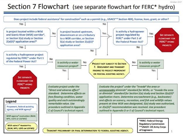
Since many Wild and Scenic River projects that would trigger Section 7 review would have involvement by the Army Corps of Engineers, it is important to develop good working relationships with local Corps districts. In Massachusetts, general permit language has been developed.
An example of a U.S. Army Corps of Engineers WSR General Permit condition for Wild and Scenic Rivers in Massachusetts is as follows:
Section 8. of the Wild and Scenic Rivers Act
Resources for Section 7 from RMS include:
What are examples of successful river management projects?
This section of the PWSR Toolkit is meant to highlight PWSR accomplishments and river management successes. It is meant for sharing exciting projects and examples from those rivers that have already achieved designation and for those investigating the positive impacts that designation may bring.
Since the Partnership Wild and Scenic River program does not increase federal ownership of land, there are other ways that conservation organizations support land protection if it is sought. This may be through funding for surveys, appraisals, support for land trusts, leveraging of funds for purchase or conservation easements or small grant programs.
Annual Reports & Accomplishments
The Partnership Wild and Scenic Rivers 20 Years of Success Report is a great place to see examples of partnerships that have led to successful projects.
Annual Reports and accomplishments also illustrate the work of Partnership Wild and Scenic Rivers each year.
Here is an example of Annual Reports and Accomplishments from the Lamprey River, NH. They also created a 20 years of success report for the Lamprey River (Lamprey River, New Hampshire - 20 Years of Progress 1996-2016).
“As to successes, we have had a very active role in protecting land since in this particular Wild and Scenic Rivers program, most of the land along the river is privately owned. From 1999 to 2009, we have protected almost 2,000 acres, mostly land that lies within the 1/4 corridor along the river, including about 12 miles of river frontage. We have produced a 22-minute video about the river, and have offered grants to enhance our outreach efforts. We have also supported watershed-wide activities such as a conference last June to support watershed planning. We've published a curriculum for grades 3-12, developed a recreational map for the 23.5 miles of the river that are in the Wild and Scenic Rivers program, and are currently working with the town of Durham on a small park. We have some wonderful partners in our endeavors and we strive to work more closely with the four towns in the Wild and Scenic portion of the river.” Sharon Meeker – Lamprey River (NH)
Yet, these reports never really seem to capture the breadth and scope of accomplishments on PWSRs.
Promoting Outreach and Education
All rivers participate in Outreach and Education. Coordination of activities can also occur at the national level. For example, a Wild and Scenic River Junior River Ranger activity sheet was recently created in English and in Spanish, which is made available to any group or individual that would like to participate in this outreach effort.
Telling the unique stories of PWSR designation is a great way to educate community members about the benefits of designation.
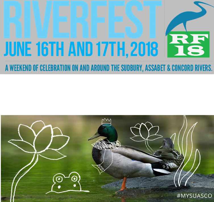 |
River Festival (Sudbury, Assabet, and Concord (SuAsCo) Rivers, MA)
The Riverfest weekend featured more than 30 events in nine communities, free and open to all who wanted to experience the river. There were boat rides, bird watching walks, and canoe trips, as well as historical reenactments, art activities, and music. Kids enjoyed events allowing them to explore the riverbanks or het an up-close look at some wildlife.
Photo: Riverfest 18 Poster, the words ‘Riverfest June 16th and 17th, 2018: A weekend of celebration on and around the Sudbury, Assabet, and Concord Rivers’ are emblazoned across the top along side the Riverfest 18 logo which consists of a logo of a crane sitting atop a light green block with the text ‘RF18’ contained within the square. At the bottom of the poster an image of a mallard is shown with playful child-like doodles on top.
|
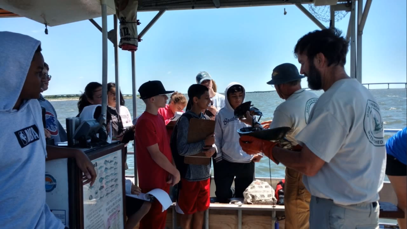 |
Educational Events for Students (Great Egg Harbor, NJ)
Students enjoy educational events on the Great Egg Harbor Bay on the Duke of Fluke boat while fishing. The great program gets students out on the river is funded by the Great Egg Harbor River Council.
Photo: A group of students are standing around two men in gloves holding fish. The children are experiencing the educational event on the Duke of Fluke boat while fishing on the Great Egg Harbor Bay.
|
|
|
River Sojourn (Lower Delaware River, NJ & PA)
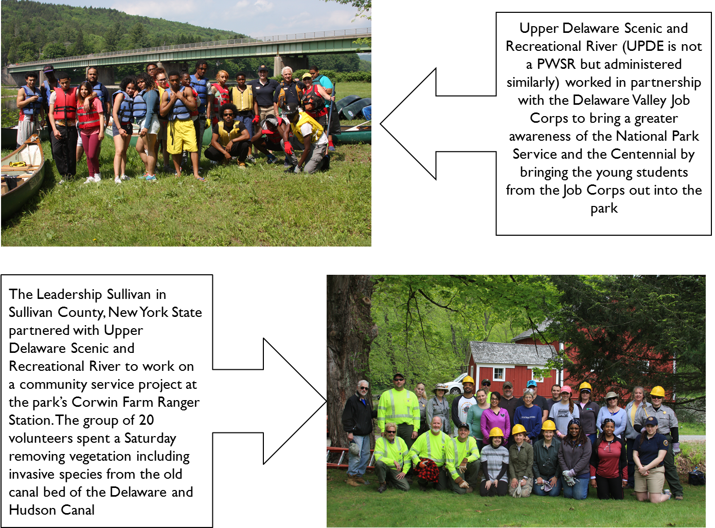
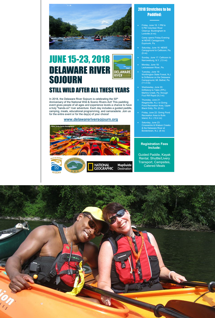
The Sojourn is a seven- or eight-day guided paddling trip on the Wild and Scenic Lower Delaware River, combining canoeing/kayaking, camping, educational programs, historical interpretation, and more. The purpose of the Sojourn is to heighten awareness of the appreciation for the Delaware and its watershed, which flows for 330 miles through New York, New Jersey, Pennsylvania, and Delaware.
Photo 1: A group photo of a cohort of Delaware Valley Job Corps members with an arrow pointing to it with a caption reading ‘Upper Delaware Scenic and Recreation River (UPDE is not a PWSR but administered similarly) worked in partnership with the Delaware Valley Job Corps to bring a greater awareness of the National Park Service and the Centennial by bringing the young students from the Job Corps out into the park. Another photo depicts a group of 20 volunteers on the Upper Delaware Scenic and Recreational River. An arrow points to the photo with a caption reading ‘The Leadership Sullivan in Sullivan County. New York State partnered with Upper Delaware Scenic and Recreational River to work on a community service project at the park’s Corwin Farm Ranger Station. The group of 20 volunteers spent a Saturday removing vegetation including invasive species from the old canal bed of the Delaware and Hudson Canal.
Photo 2: A flyer for the Delaware River Sojourn taking place on June 15-23, 2018. The bottom of the image includes an image of a couple kayaking in separate kayaks with the man leaning his head on the woman’s shoulder.
|
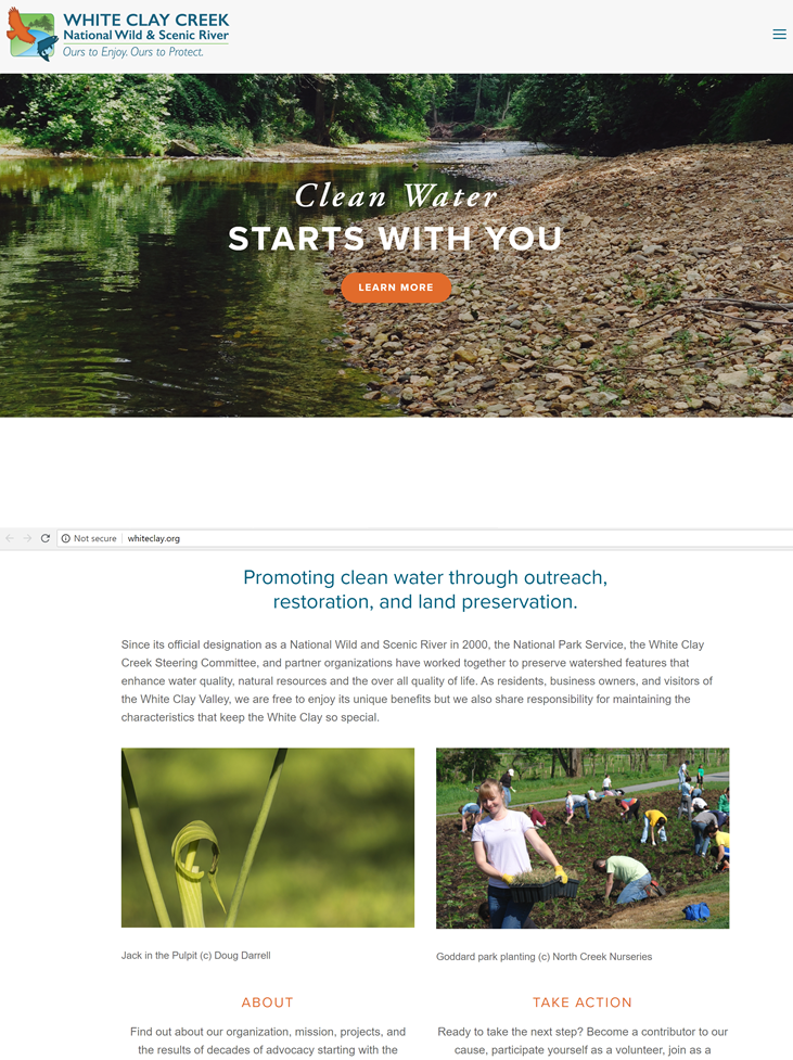 |
Rain Gardens (White Clay Creek, PA)
The Goddard Park rain gardens tell a story of a community coming together to promote water quality, enhance park aesthetics, and create a better habitat for local pollinators and other native fauna. This is just one of many stories that illustrates a project beneficial to both local residents and the water quality of the White Clay Creek.
Photo: A screen capture of the White Clay Creek, National Wild and Scenic River Website. The bottom of the screencap provides some information about the White Clay Creek Steering Committee.
|
 |
Partner Spotlight - Origin Story (Lamprey River, NH)
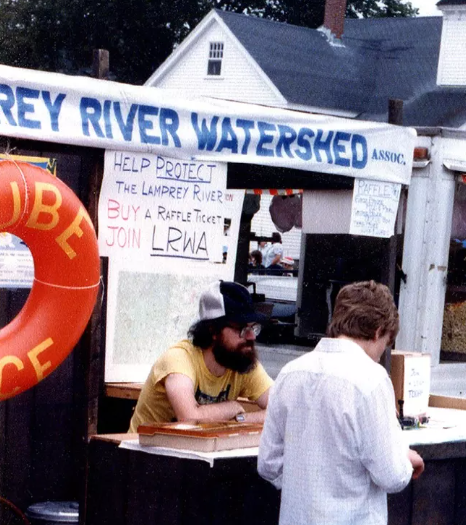
Since 1983 volunteers have worked to protect the rich resource that flows through our communities. The Lamprey River Watershed Association (LRWA) successfully pursued state recognition for a section of the river and later the entire watershed. The Lamprey River Advisory Committee (LRAC) successfully pursued federal designation. We hope you are inspired by this Lamprey designation video! Read the Partner Spotlight and Designation Origin Story featuring Dick Lord, who helped to incorporate the Lamprey River Watershed Association (LRWA).
Photo: Dick Lord at LRWA booth promoting tube races. Photo provided by RH Lord.
|
 |
Women of Wild and Scenic VT (Upper Missisquoi and Trout Rivers (UMATR), VT)
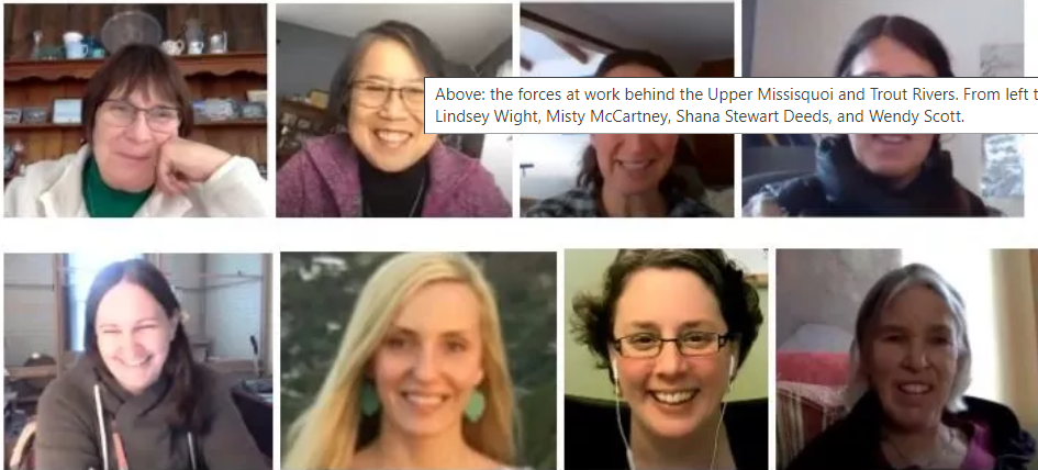
Read the Partner Spotlight- Women of Wild and Scenic VT to learn about the women behind the scenes of Wild and Scenic Vermont Rivers.
Photo: Screenshot - the forces at work behind the Upper Missisquoi and Trout Rivers. From left to right: Carol Hickey, Cynthia Scott, Ellen Fox, Karrie Thomas, Lindsey Wight, Misty McCartney, Shana Stewart Deeds, and Wendy Scott.
|
 |
Pathways through Partnerships (Taunton River, MA)
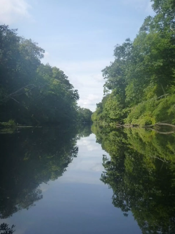
The Taunton River Stewardship Council (TRSC) has been working together with federal, state, and local organizations for more than a decade to improve water quality, enhance public safety, and restore aquatic habitat on the Mill River, a major tributary of the Taunton River, in Taunton, Massachusetts. To date, the Mill River Partnership project has reconnected 30 miles of intact mainstem and tributary habitat in the upper Mill River watershed to the Taunton River and Narragansett Bay by removing three dams and constructing fish and eel ladders at a fourth (which was entirely rehabilitated as part of a state bridge improvement project). Read the Partnership Spotlight - Highlighting River Partnerships on the Taunton River.
Photo: River Photo courtesy of Monica Bentley.
|
 |
River Festival (Sudbury, Assabet and Concord Rivers, MA)
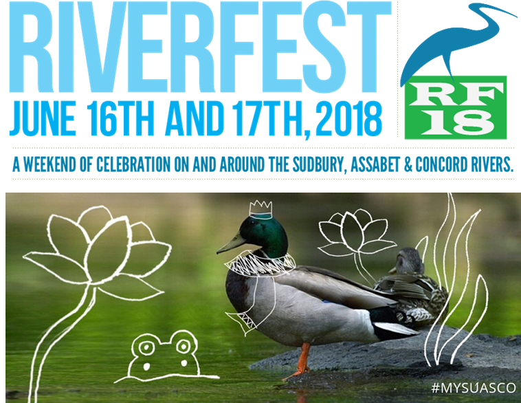
The 2018 Riverfest on the Sudbury, Assabet, and Concord Rivers in MA is a weekend that features more than 30 events in nine communities, free and open to all who wanted to experience the rivers. In the MetroWest area, from Framingham to Lowell, events were hosted on and along the rivers highlighting all the things that make these rivers so special. The offerings were diverse, suitable for younger and older people, those who are adventuresome and want to be on the water, as well as those who enjoy history, the arts, or a scenic stroll along the river banks. There were boat rides, bird watching walks, and canoe trips, as well as historical reenactments, art activities, and music. Kids enjoyed events allowing them to explore the river banks or got an up close look at some wildlife. Riverfest 2019 celebrated the 20th anniversary of the SuAsCo Wild and Scenic River designation.
Photo: Flyer for Riverfest 2018 on the Sudbury, Assabet, & Concord Rivers. Riverfest 18 is held on June 16th and 17th.
|
 |
Outreach and Education - Remote Riverfest during COVID-19 (Sudbury, Assabet and Concord Rivers, MA)
Riverfest, a signature event of the Sudbury, Assabet, and Concord Wild and Scenic River Stewardship Council, is the annual celebration of the federally protected Sudbury, Assabet and Concord Wild and Scenic River. Due to the pandemic, the 2020 Riverfest was held virtually. Nothing could completely replace the festivities of past in-person events, but participants were encouraged to explore, learn, and enjoy the rivers through activities at home or along the rivers on their own. Read more about the Remote Riverfest During COVID.
Photo: Riverfest Promotion.
|
 |
Outreach and Education - Educational Network from River to Sea (Sudbury, Assabet and Concord Rivers, MA)
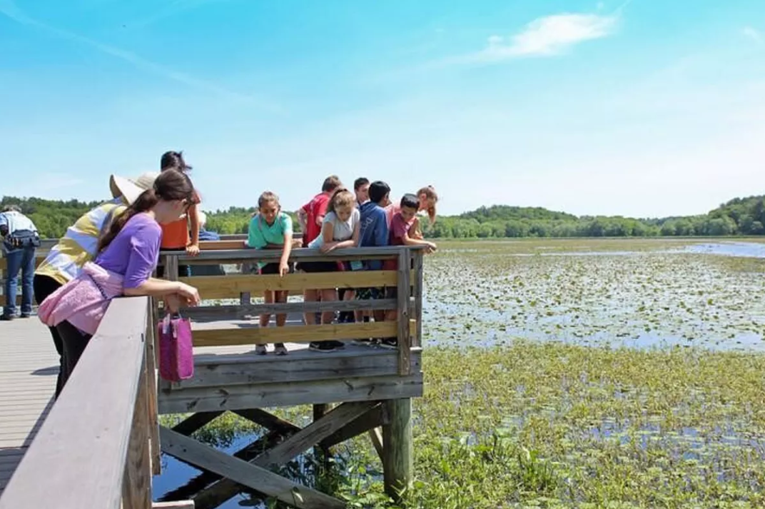
The Sudbury, Assabet, and Concord (SuAsCo) Wild and Scenic River Stewardship Council (RSC) has partnered with Mass Audubon group to bring the science of rivers to schools in the watershed. The RSC provided a significant amount of funding through their grant program to support the work that Mass Audubon does along the river. The nonprofit is dedicated to protecting the nature of Massachusetts, and is working towards bringing this unique outdoor education program across the state. For the kids and teachers involved, the river not only became a part of the curriculum, but a part of the classroom. Read more about Riverschools.
Photo: The Riverschools program is based both in the classroom and outdoors. Visiting the river is a highlight for the educators and students alike. Above shows the Great Meadows National Wildlife Refuge. Photo credit: Kelly Moffett.
|
 |
Recreation and Outreach - Wander our Watershed (Eightmile River, CT)
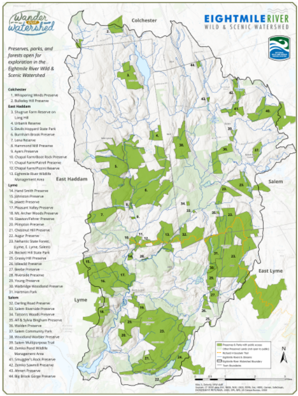
Following designation, the Eightmile River Wild and Scenic Coordinating Committee (ERWSCC) continues to discuss management strategies that further the preservation of this watershed. The preservation of this watershed relies primarily on locally-led initiatives and strategies to protect the resources within the Eightmile River Watershed. One benefit of Wild and Scenic River designation has been increased public support and State funding for land acquisition. Preservation of public land is a goal of all of the partners in this Wild and Scenic watershed - including the Coordinating Committee, the CT DEEP, The Nature Conservancy, local towns and land trusts. The efforts of these partners have led to the preservation of about 40% of the lands in the watershed! To illustrate these special areas, the Eightmile River’s new preserve map was created. Read more about the preservation of this watershed's open space.
Photo: The Eightmile River’s new preserve map was created through the combined efforts of partners and the GIS work of Riley Doherty, the Eightmile River’s Environmental Program Coordinator.
|
 |
Conservation - Terrapin Research (Taunton River, MA)
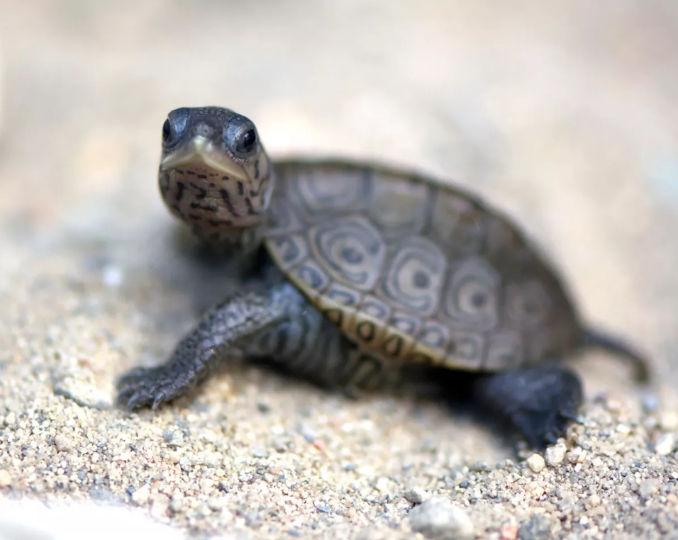
In partnership with the State, the Taunton River Watershed Alliance (TWRA) has been funding terrapin research along the lower stretches of the river.
Photo: The diamondback terrapin (Malaclemys terrapin) is a unique turtle species. Photo credit: Sally Spooner.
|
Improving Relevancy, Diversity, Equity, & Inclusion
 |
Relevancy, Equity and Inclusion
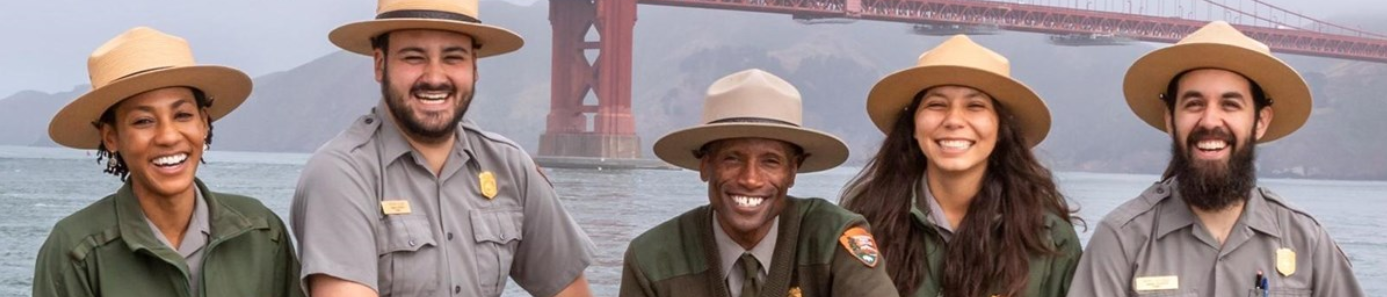
Find out more about how NPS is working to improve Relevancy, Equity and Inclusion.
Photo: Diverse staff at NPS.
|
 |
Fostering Community Leadership Toolkit
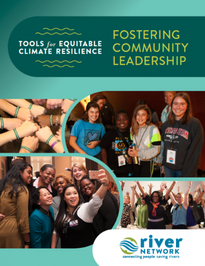
River Network has a Fostering Community Leadership Toolkit, which is looking at both climate resilience and inclusion. “With the support of the Kresge Foundation, River Network embarks on the journey of exploring climate resiliency strategies and equitable engagement of communities in climate resilience work.”
Photo: River Network's Tools for Equitable Climate Resilience: Fostering Community Leadership
|
 |
Recreation Outreach Strategies
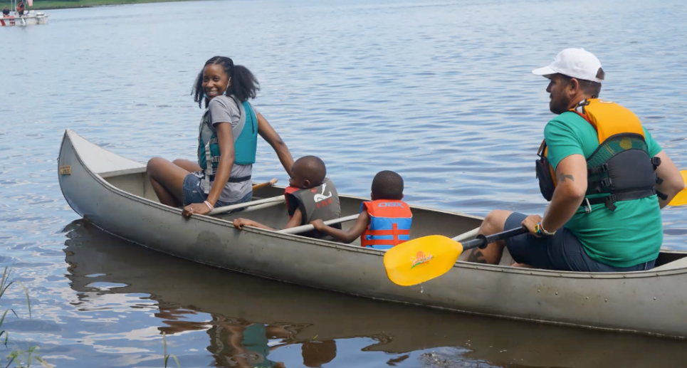
Read this article to learn more about River Network’s recreation outreach strategies.
Photo: A family of four paddles on the Photo via CU Maurice River.
|
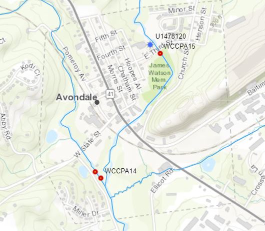 |
Environmental Justice Community Avondale Borough
Avondale Borough is an environmental justice community located at the confluence of the east and west forks of the East Branch of White Clay Creek, a federally designated Wild and Scenic River. Borough residents, largely Latino with low to median household income, frequently experience flooding to the point where emergency evacuations and housing displacements are required. Join this workshop to learn about a climate resiliency project in which planning agencies tackled flooding issues in the Borough. Learn how National Park Service and Wild and Scenic Staff successfully competed for funding through the National Fish and Wildlife Foundation's Delaware River Restoration funding but pivoted the project from a more traditional engagement model to one that facilitates community leadership so that the planning process centers on community need. Drawing from River Network's Community-Led Research Toolkit, and with an additional technical assistance grant with the River Network, the project now draws the community in developing a shared understanding of how climate change impacts them and in identifying more equitable climate resilience strategies that provide multiple benefits to those most directly impacted. The project has re-envisioned how community members can engage with planning processes that directly impact them. An outcome of this project when completed will involve design and implementation of site flooding remediation project(s) that meet both the needs and desires of the community, while also alleviating some of the impacts from stormwater runoff thus expanding climate resiliency for this at-risk community. What will work, and what won't work? What will be the lessons learned along the way, and the lasting legacy? Join us in a conversation full of humility in November to hear more about our learning processes and the outcomes.
|
Supporting Community/Citizen Science
 |
Endangered Species Research (Lamprey River, NH)
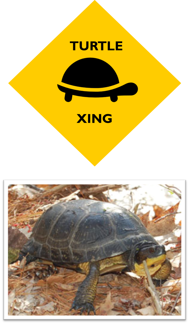
Lamprey River Blanding’s turtle research efforts document endangered species and their habitat to allow for protection and education programs for private landowners.
Photo: Lamprey River Blanding’s Turtle - A yellow diamond sign with a logo of a turtle in the center the words ‘Turtle Xing’ surround the logo. The bottom of the image has picture of a Blanding’s turtle crawling along the forest floor.
|
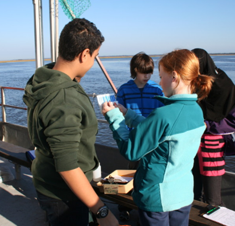 |
Water Quality Testing, Student Education, Stewardship (Great Egg Harbor, NJ)
Great Egg Harbor River Council funds trips for students from local schools learn about animals in the bay. They also test the water quality and pick up trash.
Photo: Great Egg Harbor Education - A group of thee students from a local school are huddled around one girl who is holding a water quality strip and chart.
|
|
|
Mercury Testing (Maurice River, NJ)
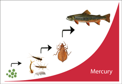
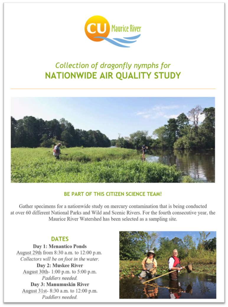
Since mercury is threatening the integrity of natural resources, The NPS, USGS and the University of Maine aim to generate baseline data the better understand the distribution of mercury in the environment and the damage it is causing. Citizens United to Protect the Maurice River & Its Tributaries (CU Maurice River) helps gather specimen on the Wild and Scenic Maurice River for the nationwide study.
Photo 1: Maurice River Biomagnification - A poster depicting how mercury makes its way up the food chain. As microbes are eaten and absorbed by nymphs and bugs, who are then eaten by fish the level of mercury increases drastically.
Photo 2: Flyer for the collection of dragonfly nymphs for Nationwide Air Quality Study. The Flyer reads ‘Be Part of this Citizen Science Team! Gather specimens for a nationwide study on mercury contamination that is being conducted at over 60 different National Parks and Wild and Scenic Rivers. For the fourth consecutive year, the Maurice River Watershed has been selected as a sampling site.’ The flyer proceeds to give dates, times, and who or what is needed for collection.
|
|
|
Ecosystem Education for Students (Upper Missisquoi and Trout Rivers, VT)
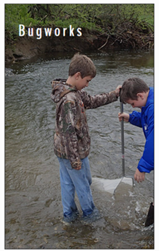
The Missisquoi River Basin Association has been offering Bugworks programs since 2008. Created by MRBA Board President John Little*, Bugworks teaches students the importance of invertebrates to stream health. In addition to studying phosphorus and nitrogen loads throughout the watershed, this program teaches children that bio-monitoring, or looking at life forms in the water, can be a good indicator of ecosystem health.
Photo: Two children are wading in the Missisquoi and Trout Rivers, the water is hitting their ankles while they are both holding a single net in the river. The word ‘Bugworks’ in white sits in the upper left corner of the image.
|
|
Conservation and Outreach: Dragonfly Mercury Project (Wekiva River, FL and Maurice River, NJ)
Mercury testing on the Maurice River in NJ is one way that Partnership Wild and Scenic Rivers supporting scientific research and utilizing the power and partnerships of citizen/community science research. Learn more about the Dragonfly Mercury Project and check out the NPS' Partner Spotlight on how Maurice River volunteers are making a difference with this project.
Photo: Flyer for the collection of dragonfly nymphs for Nationwide Air Quality Study. The Flyer reads ‘Be Part of this Citizen Science Team! Gather specimens for a nationwide study on mercury contamination that is being conducted at over 60 different National Parks and Wild and Scenic Rivers. For the fourth consecutive year, the Maurice River Watershed has been selected as a sampling site.’ The flyer proceeds to give dates, times, and who or what is needed for collection.
|
Strengthen Partnerships and Historic Cultural Resources
Our nation continues to work toward celebrating the history and culture of all people across the United States. The National Park Service is helping to Tell All Americans’ Stories.
The Westfield River promotes the Indigenous Voices in the Outdoors: Rethink Outside Webinar on their Facebook Page: https://vimeo.com/750133023
 |
Conservation - Watershed Association Interpretive Center (Musconetcong, NJ)
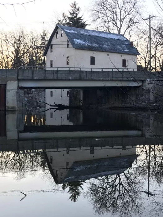
The PWSR News highlighted how the historic Asbury Grist Mill, along the Musconetcong Wild and Scenic River, has been restored to serve as an Interpretive Center and Office Space. Learn about the restoration of the Asbury Grist Mill.
Photo: Asbury Mill photo courtesy of the Musconetcong Watershed Association (MWA).
|
 |
Outreach and Education - River Quilt (Farmington River, CT)
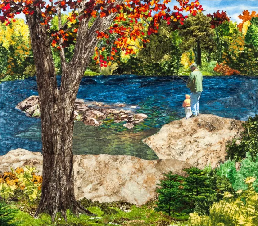
The Farmington River Quilt is comprised of 25 locations along the Farmington Wild and Scenic River and is 50 feet long. It was created by 24 independent quilters who took inspiration from separate sections along the river. Some of the featured places in the quilt include Goodwin Dam, High Bank Rapids, and Pleasant Valley Ridge.
Photo: Lyman’ Rock Quilt Square by Dan Gough image courtesy of the Farmington River Quilt Project.
|
Creating Climate Resiliency
 |
US Climate Resilience Toolkit
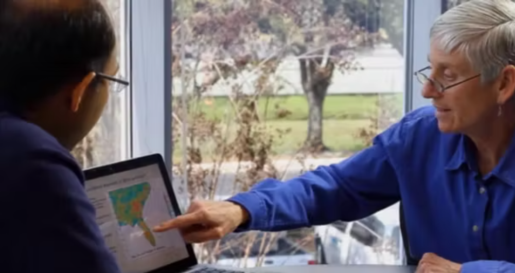
No current river management would be complete without addressing climate resiliency. Resilience, as defined by the US Climate Resilience Toolkit, is the “capacity of a community, business, or natural environment to prevent, withstand, respond to, and recover from a disruption.” Many PWSRs are addressing climate change in updates to their management plans.
Photo: US Climate Resilience Toolkit: Two men review climate data.
|
|
Fostering Community Leadership Toolkit
River Network has a Fostering Community Leadership Toolkit, which is looking at both climate resilience and inclusion.
“With the support of the Kresge Foundation, River Network embarks on the journey of exploring climate resiliency strategies and equitable engagement of communities in climate resilience work.”
Photo: River Network's Tools for Equitable Climate Resilience: Fostering Community Leadership
|
 |
Climate Resiliency Toolkit
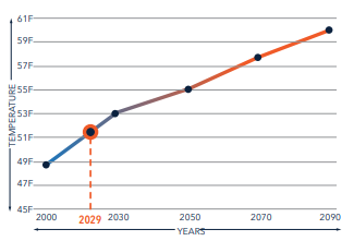
Alison Field-Juma, Executive Director of OARS: For the Assabet, Sudbury, and Concord Rivers is working with the Massachusetts Ecosystem Climate Adaptation Network (MASS ECAN) to develop a toolkit on climate resiliency. After projecting the impacts of climate change, OARS is working to advance climate adaptation through watershed-scale collaboration. They have formed a Climate Resiliency Coalition for the SuAsCo Watershed.
Photo: Average Temperature Forecast for SuAsCo Watershed Basin.
|
Protecting Lands
Many Partnership Wild and Scenic Rivers utilize some of their funds to create a small grants program in their communities. Supporting land protection can occur through these grants and provide money for surveys and appraisals, for staff support to land trusts, and for coordination of efforts by post-designation advisory committee staff if desired.
 |
Conservation and Stewardship of Rivers and Streams (Westfield River, MA)
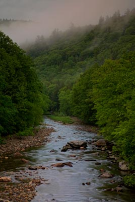
The Westfield Wild and Scenic Committee’s short-term goal is to conserve and protect 75 miles of rivers and streams in the watershed and support 15 riparian conservation projects. The Riparian Conservation & Stewardship Grant Program is designed to encourage stewardship of riparian lands and to support transaction costs leading to their long-term protection.
Photo: The Westfield Wild and Scenic River flowing through a thick forest. The Riverbanks are strewn with many rocks with a few larger rocks peeking out from the middle of the river. There is fog rolling out from the top of the trees.
|
 |
Protecting a Key Acre (Great Egg Harbor, NJ)
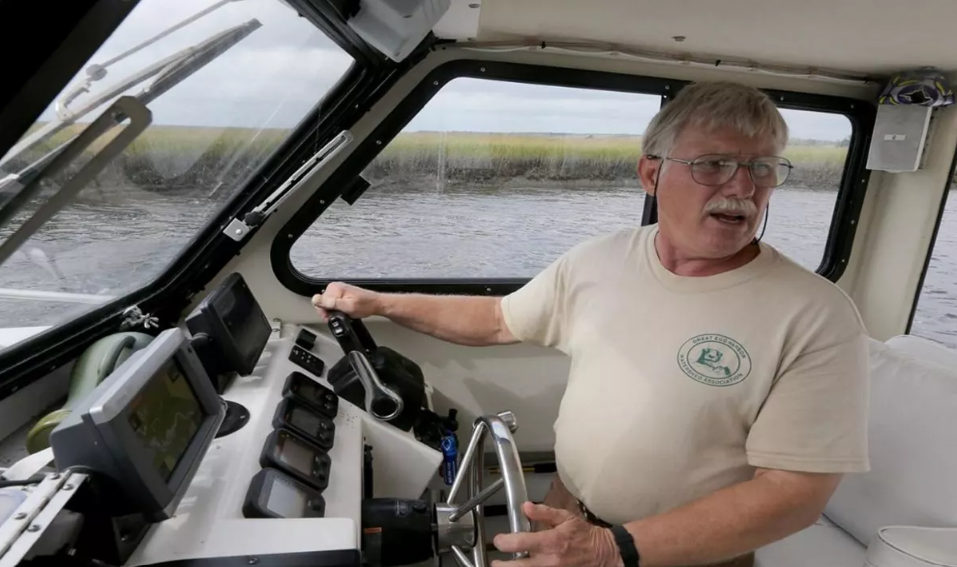
A key acre at the confluence of the Great Egg Harbor Wild & Scenic River and Babcock Creek was permanently placed under protection this spring due to the efforts of the Great Egg Harbor Watershed Association’s (GEHWA) Fred Akers. Read more about Fred Akers' work to protect this Key Acre through Green Acres.
Photo: Fred Akers in one of his favorite places: on the river steering a boat. Fred is Great Egg Harbor’s Wild and Scenic River Administrator and has been a major force in getting key conservation allotments for the Great Egg. Photo by Dale Gerhard, Staff Photographer The Press of Atlantic City.
|
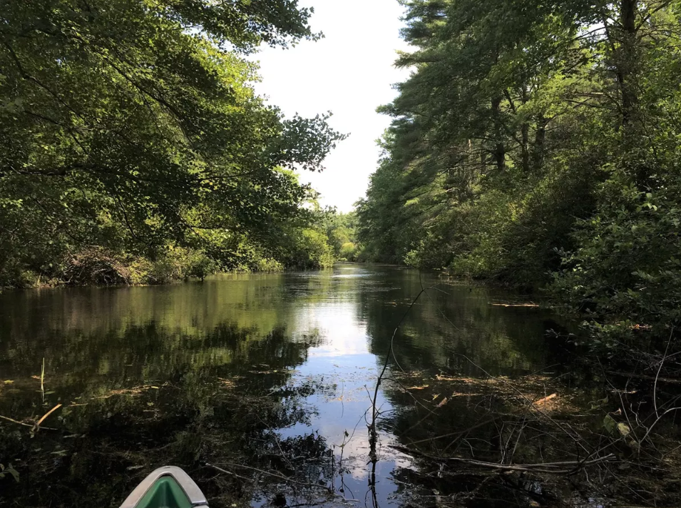 |
Conservation - Forest Legacy Program (FLP) Application (Nashua, Squannacook, and Nissitissit Rivers, MA/NH)
Administered nationally by the U.S. Forest Service and statewide in Massachusetts by the Massachusetts Department of Conservation and Recreation, the Forest Legacy Program (FLP) uses both fee-simple land purchases and permanent conservation easements to protect environmentally important forest areas that are threatened by conversion to non-forest uses. Partnering with local and regional land trusts, conservation commissions, state agencies, and other organizations, the Stewardship Council is working to identify tracts of important, threatened, and strategically located forested lands which, when aggregated together, could produce a competitive application for the federal FLP. Landowner outreach has been robust in the past couple of months, with the goal of working with willing landowners to commit +1,000 acres of forested land for protection.
Photo: Nissitissit Wild and Scenic River photo by Emma Lord.
|
Restoring Rivers and Water Quality
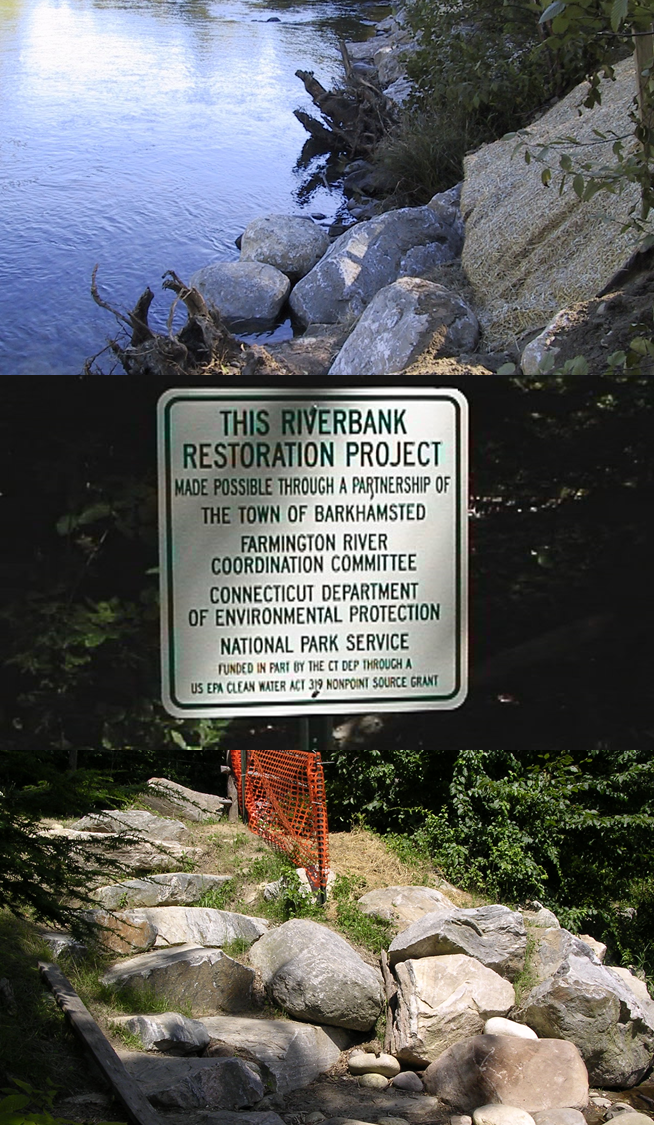 |
Bank Stabilization (Farmington River, CT)
The Farmington River Coordinating Committee partnered with Town government to save the road and restore the degraded site on the West Branch of the Farmington River. The National Park Service (NPS) assisted with design, permitting, and monetary support; volunteers planted to stabilize the banks.
Photos: The top photo depicts an image of a bank in process of stabilization, with rocks and materials strewn upon the bank. The second image depicts a sign that reads ‘This riverbank restoration project made possible through the town of Barkhamsted, Farmington River Coordination Committee, Connecticut Department of Environmental Protection, and the National Park Service. Funded in part by the Connecticut Department through a US EPA Clean Water Act Nonpoint Source Grant’. The last photo shows a bank covered in large boulders and a plastic hi-res orange construction fencing erected on a small portion of the bank.
|
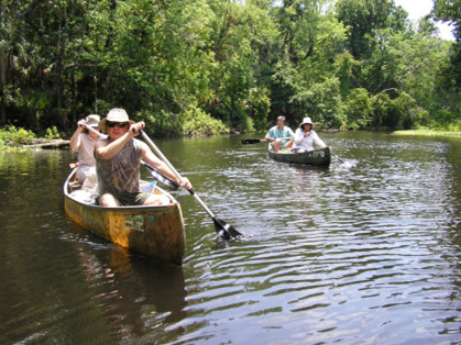 |
Invasive Plant Removal Day (Wekiva River, FL)
Organize an invasive plant removal day on the Wekiva River through the Wekiva River Ambassador program.
Photo: Four individuals are paddling down the Wekiva river on two canoes.
|
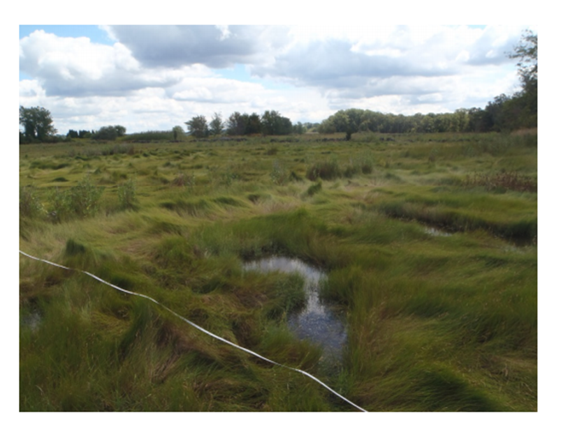 |
Support for Marsh Migration (Taunton River, MA)
The Taunton River presents an opportunity to support marsh migration through the continued protection of land adjacent to salt marches – a necessity with sea level rise.
Photo: Overlooking marshlands with sweeping thick grasses along the landscape. A small body of water dots along the bottom of the image.
|
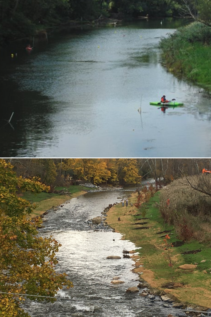 |
Dam Removal (Musconetcong River, NJ)
The Musconetcong Watershed Association leveraged funds for dam removal to restore free-flow of the river and restore anadromous fish.
Photo: The Musconetcong River during high water level after a dam removal. The dam removal and high waters allow for kayakers who are paddling down the river unimpeded.
|
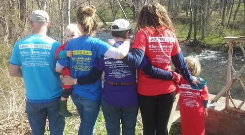 |
River Cleanup (Musconetcong River, NJ)
Not only does the Musconetcong Watershed Association collect trash at over 20 sites each year, they also collect information on the quantity and type of trash collected. The Cleanup Summary Form provides information on the quantity of trash and tires collected. The Litter Tally Sheet identifies the most common types of litter near the Musconetcong River, as well as any differences based on collection site. Learn more about the Musconetcong Watershed Association's River Cleanups.
Photo: Family by river after River Cleanup.
|
|
|
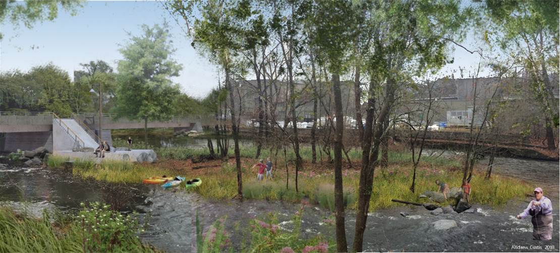
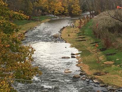
Park Redevelopment and Dam Removal (Musconetcong River, NJ)
On the Musconetcong River in NJ enhancement of recreation occurred through a National Park Foundation grant for Island Park development.
The Musconetcong River in NJ also completed river restoration work through dam removal. This work was completed with seed money from the National Park Service which allowed leverage of funds to restore free-flowing conditions on sections of the Musconetcong River. There has since been wonderful success in the restoration of an historic ORV and anadromous fish runs.
Photo 1: Rendering of completed Musconetcong River Island Park. There is a ramp leading down to a dock and access to a small wooded island.
Photo 2: Musconetcong Restoration photo by Alan Hunt. Arial view of the Musconetcong restoration project. The river now unimpeded thanks to a dam removal.
|
 |
Dam Removal (White Clay Creek, DE/PA)
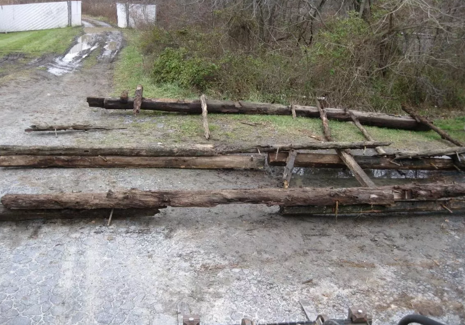
Across the country, efforts have been underway to remove dams that have outlived their intended purpose and have detrimental ecological effects or pose a safety hazard. On White Clay Creek (WCC) Wild and Scenic River, the successful removal of the first of seven dams has opened the way for improved ecosystem health and fish passage. Read the Partner Spotlight about Dam Removal on White Clay Creek.
Photo: “It’s much more fun to take a dam down than to build it,” Jerry said. The permitting for the dam removal required historic preservation, so the timber dam was documented, preserved and is stored by the University. Photo Credit: Doug Janiec.
|
 |
Water Quality - Catch the Rain (White Clay Creek, DE/PA)
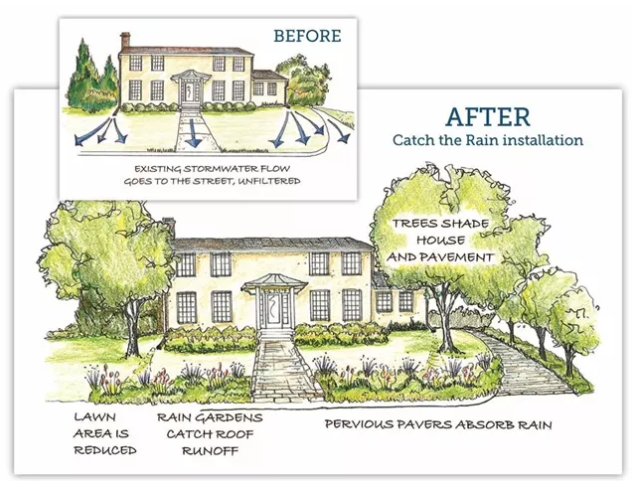
The Catch the Rain Program strives to improve water quality by promoting Green Stormwater Infrastructure (GSI) practices. These practices are designed to capture and detain rainfall, reduce the overall stormwater speed and volume running off into the River, and stimulate the natural filtering processes of soil. Read more about the Catch the Rain Program.
Photo: Green stormwater infrastructure can improve water quality by using landscape features to capture and soak up precipitation. Credit: Catch the Rain Program website.
|
 |
Water Quality - Watershed Approach (Great Egg Harbor, NJ)
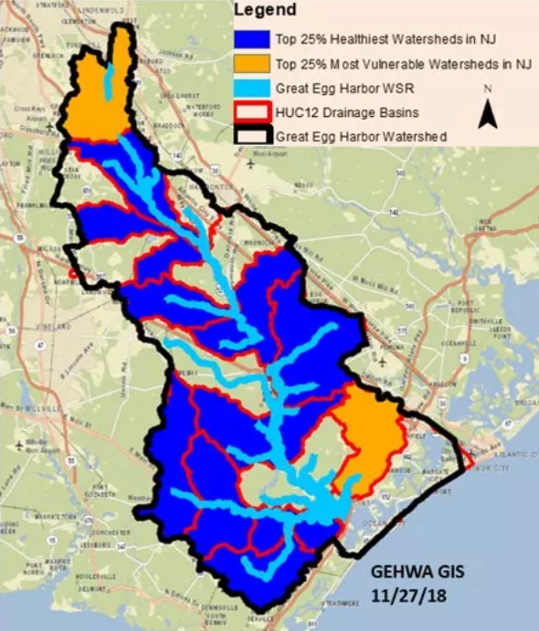
With a watershed area of about 521 square miles and 129 river miles designated by Congress in 1992 as components of the National Wild and Scenic River System, the Great Egg Harbor River Council uses a watershed approach that focuses on how watershed lands are used and how stormwater runoff is managed to address water quality protection. Read more about the water quality of Great Egg Harbor.
Photo: Preliminary Healthy Watersheds Assessments (PHWA) map produced by the GEH Watershed Association in 2018 showing the HUC12 subwatersheds and their health. Map provided by Fred Akers.
|
 |
Conservation - Living Shoreline (Maurice, NJ)
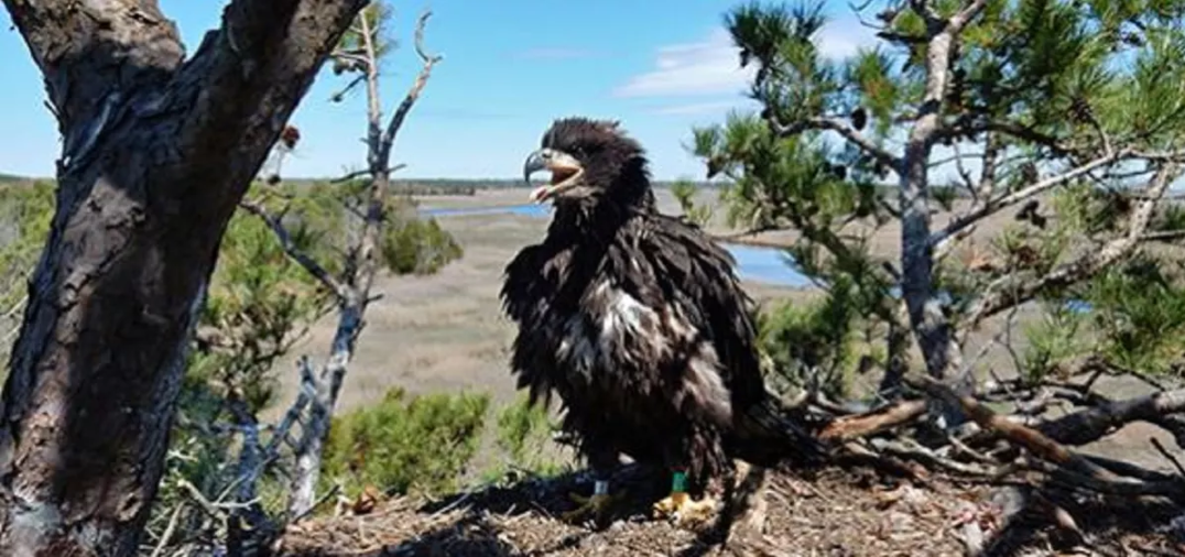
The American Littoral Society (ALS) recently submitted a U.S. Army Corps of Engineers “Living Shoreline” project application to protect the Maurice Wild and Scenic River from coastal erosion. The proposed project involves the placement of a toed-in, stone revetment at the mouth of the Maurice River and the Delaware Bay. It also involves the construction of two hybrid breakwaters at the Basket Flats and Northwest Reach reaches of the river to trap sediment and filter the brackish water. Read more about their success using a living shoreline.
Photo: CU Maurice River: An eagle sits high in the trees on the Maurice River. Courtesy of Citizens United to Protect the Maurice River & Its Tributaries (CU Maurice River).
|
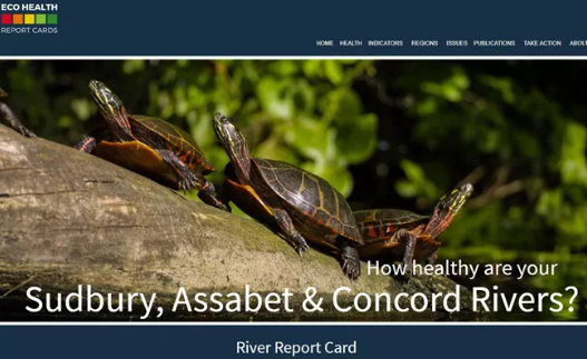 |
Water Quality - River Report Card (Sudbury, Assabet, and Concord (SuAsCo) Rivers, MA)
In order to assess the health and water quality of the Sudbury, Assabet and Concord Rivers, a Report Card was developed. Read more about the SuAsCo River Report Card.
Photo: Sudbury, Assabet & Concord Rivers River Report Card
|
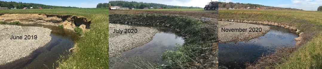 |
Conservation - Bank Stabilization (Upper Missisquoi and Trout Rivers (UMATR), VT)
Getting National Park Foundation funding to complete a bank stabilization project on Mill Brook in Westfield was a big success for the Upper Missisquoi and Trout Rivers (UMATR) Committee this year.
Photo: Photo of bank stabilization over time provided by Lindsey Wight of UMATR.
|
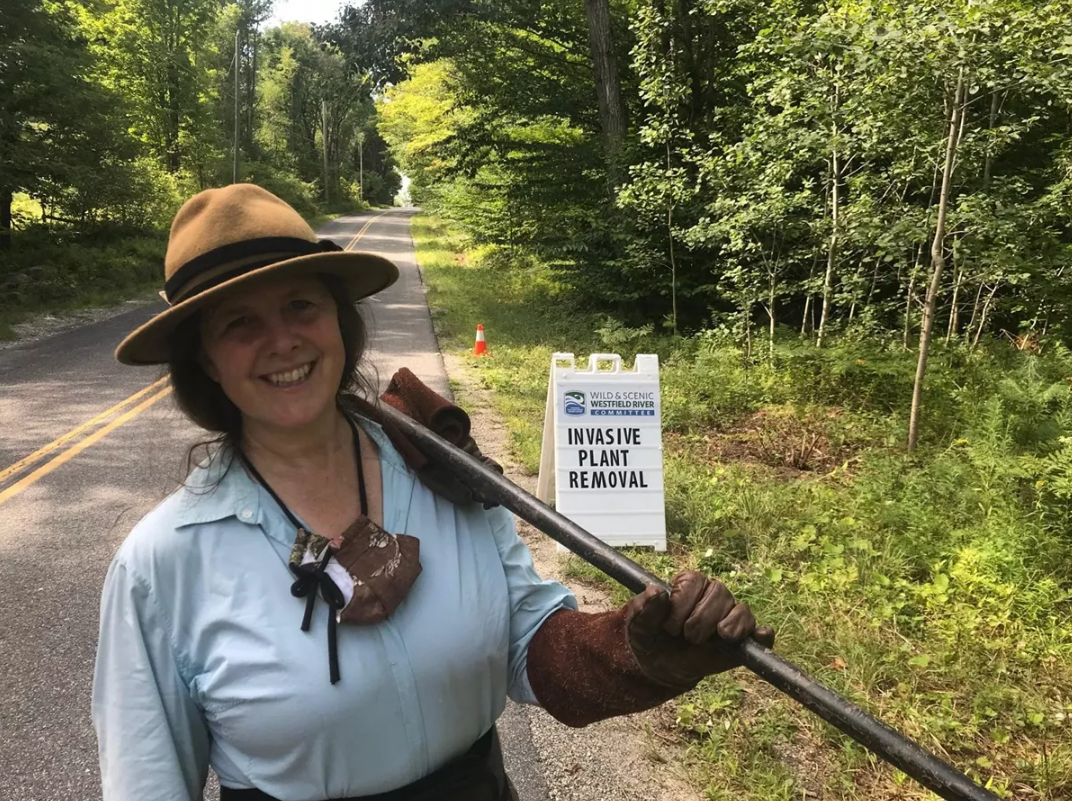 |
Conservation - Invasive Species (Westfield, MA)
In order to combat invasive species, the Westfield Wild and Scenic River is fortunate enough to have active partnerships with local volunteers, government officials, conservation organizations, and other specialized groups. Read more about how these groups of partnered to achieve success managing invasive species on the Westfield.
Photo: Meredyth Babcock is all smiles after a day of hard work removing invasive plants. These types of workdays are important so that native plants are not outcompeted by invasive species. Photo Credit: Westfield Wild and Scenic River Facebook page.
|
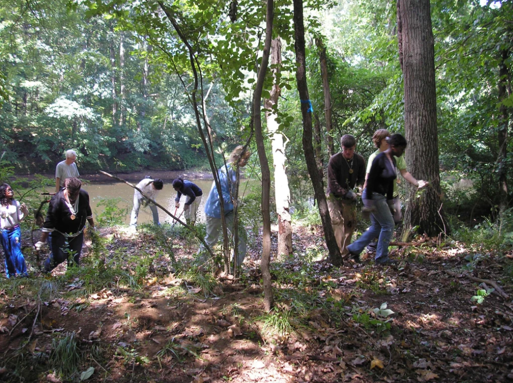 |
Resilience/Perseverance - What happens if you don't get designated right away? (Lower Farmington and Salmon Brook Rivers, CT)
The Lower Farmington and Salmon Brook designation took a while after the study was completed. Their Committee is a wonderful example of how to keep volunteers engaged and motivated while working toward the goals in their management plan. Check out their stewardship and events to see how they persevered between study and designation.
Photo: Study Committee sponsored invasive plant removal project at Fisher Meadow, Avon. Photo by Joyce Kennedy.
|
Enhancing Recreation
 |
20 Years of Success Report
The successful river management projects listed above that have been implemented through Wild and Scenic Committees with their funding are some of these examples of success. The 20 Years of Success report recently published by the NPS illustrates these successes as does the PWSR Video River Connections.
|
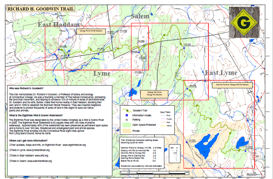 |
Watershed Multi-Use Trail (Eightmile River, CT)
Eightmile River Wild and Scenic Watershed Richard H. Goodwin Multi-use Trail
Photo: Map of the Richard H. Goodwin Trail, the map provides information on the path of the trails, whether the land is on protected and/or private land, and parking and information kiosks locations. Information on who Richard H. Goodwin was and what is the Eightmile Wild & Scenic Watershed is also provided.
|
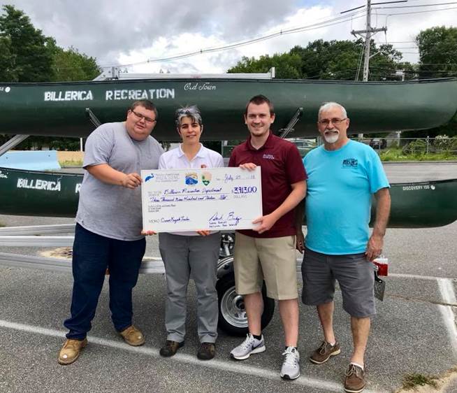 |
Canoe Trailer and Facebook Group for Advertising (Sudbury, Assabet & Concord (SuAsCo) Rivers, MA)
The group gave a grant to the Town of Billerica to purchase a canoe trailer and created a Facebook group to advertise paddling events.
Photo: Presentation of a check for the canoe trailer purchase. The canoe trailer sits behind the 4 individuals loaded with canoes. Photo from the Sudbury, Assabet, & Concord Wild and Scenic River Stewardship Council. Photo from the Sudbury, Assabet, & Concord Wild and Scenic River Stewardship Council.
|
|
|
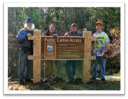
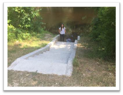
Public Canoe Access (Lamprey River, NH)
Public Canoe Access on the Lamprey River in Lee, NH.
Photo 1: Four men stand behind a newly erected Public Canoe Access sign on the Lamprey River. Pictures courtesy of Jim MacCartney, NPS, Dick Lord and Suzanne Petersen, Lamprey Rivers Advisory Committee Lamprey River, NH.
Photo 2: A woman stands at the end of concrete stairs leading to a public canoe access to the Lamprey River. Pictures courtesy of Jim MacCartney, NPS, Dick Lord and Suzanne Petersen, Lamprey Rivers Advisory Committee Lamprey River, NH.
|
|
|
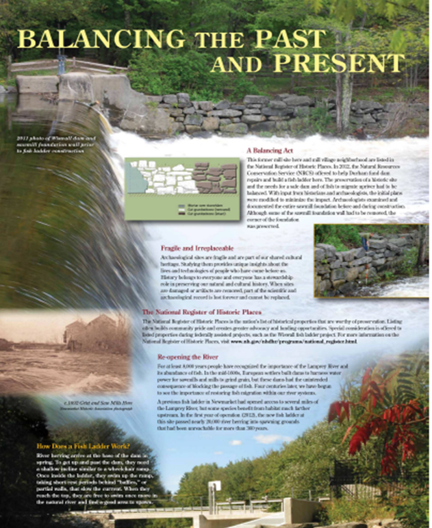
Public Park (Lamprey River, NH)
Wiswall Park
Photo: Poster Titled Balancing the Past and the Present about Wiswall Dam on the Lamprey River. The poster explains the balancing act between the preservation of a historic dam and the need for a safe dam and a means for fish to migrate upriver.
|
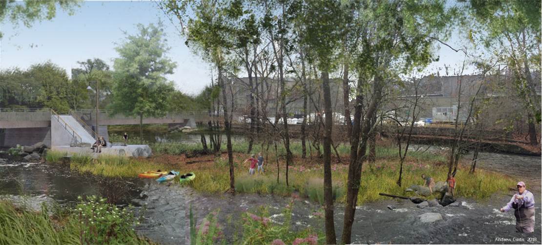 |
Island Park (Musconetcong River, NJ)
Musconetcong Island Park on the Musconetcong River is a project created to celebrate the Wild & Scenic Rivers Act’s 50th Anniversary.
Photo: Rendering of completed Musconetcong River Island Park. There is a ramp leading down to a dock and access to a small wooded island.
|
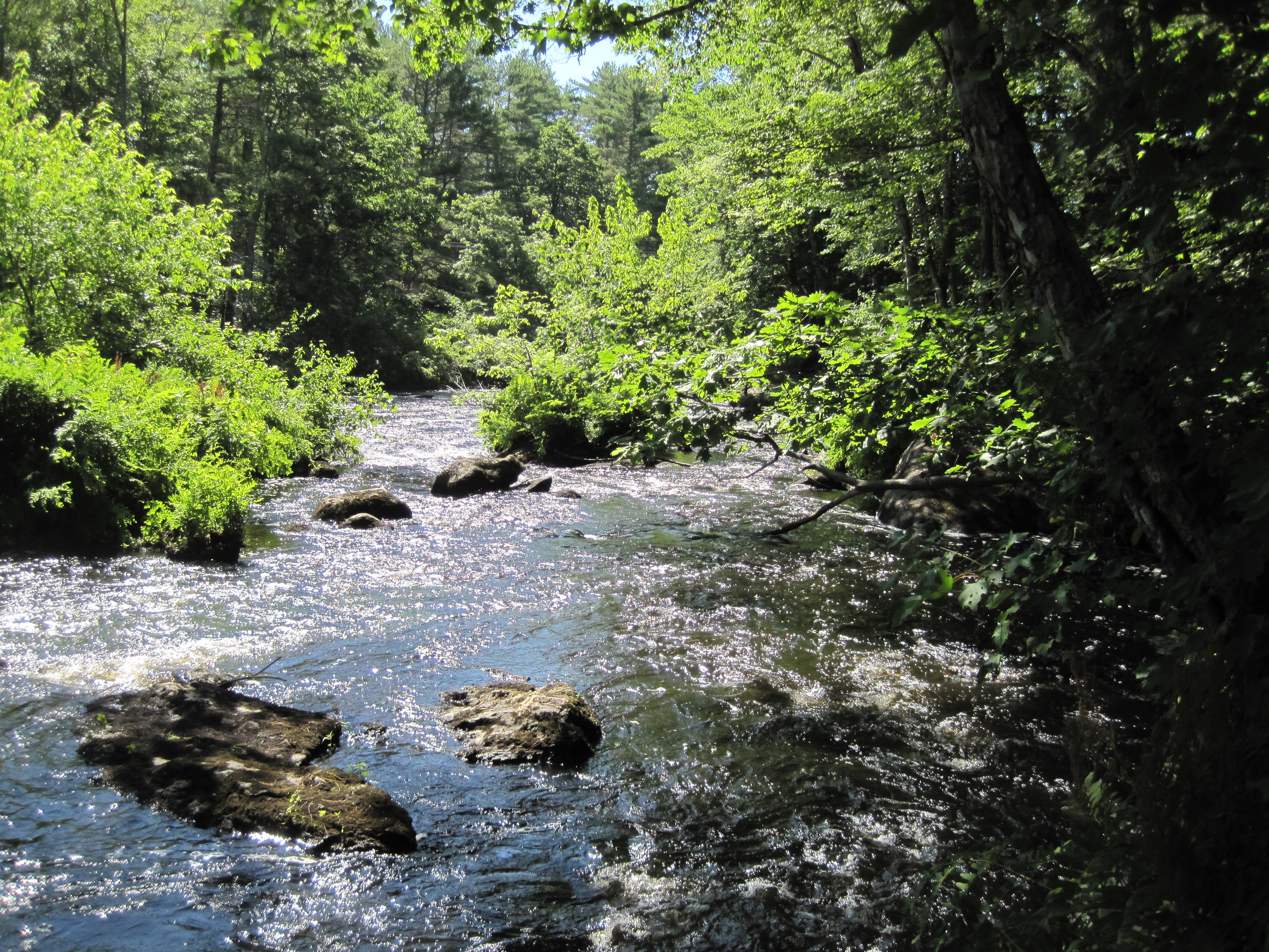 |
Wiswall Park Project (Lamprey River, NH)
One example of enhancing recreation is the Wiswall Park project on the Lamprey River in Durham, NH. This project added kiosks, created design plans for a park, restored an historic millrace, and sought assistance with 106 coordination. Under General Rules for NEPA-Section 106 Coordination, the national Advisory Council on Historic Preservation's (ACHP's) Section 106 of the National Historic Preservation Act (NHPA) regulations (36 CFR 800) prescribe certain considerations for historic properties under National Environmental Policy Act (NEPA).
Photo: Lamprey River Downstream from Wiswall Falls, the river is fast moving and heavily vegetated along the banks.
|
 |
Recreation - Delaware River Sojourn (Lower Delaware, NJ/PA)
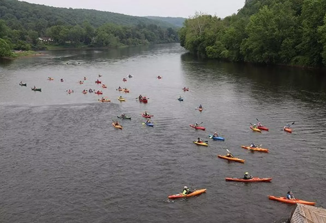
The Delaware River Sojourn marked its 25th year in 2019; that’s 25 years of celebrating a river through recreation, education, and gathering diverse groups of paddlers together. The Sojourn is a seven- or eight-day trip down the River that usually consists of around 500-600 participants throughout the paddle. While the excursion had to be cancelled in 2020, there is much to commemorate in this special Sojourn.
Photo: A typical day during the Sojourn with the river filled with paddlers. Photo courtesy of Delaware River Sojourn Facebook page.
|
 |
Conservation and Recreation - How paddling helps protect the rivers (Wood-Pawcatuck Watershed, CT/RI)
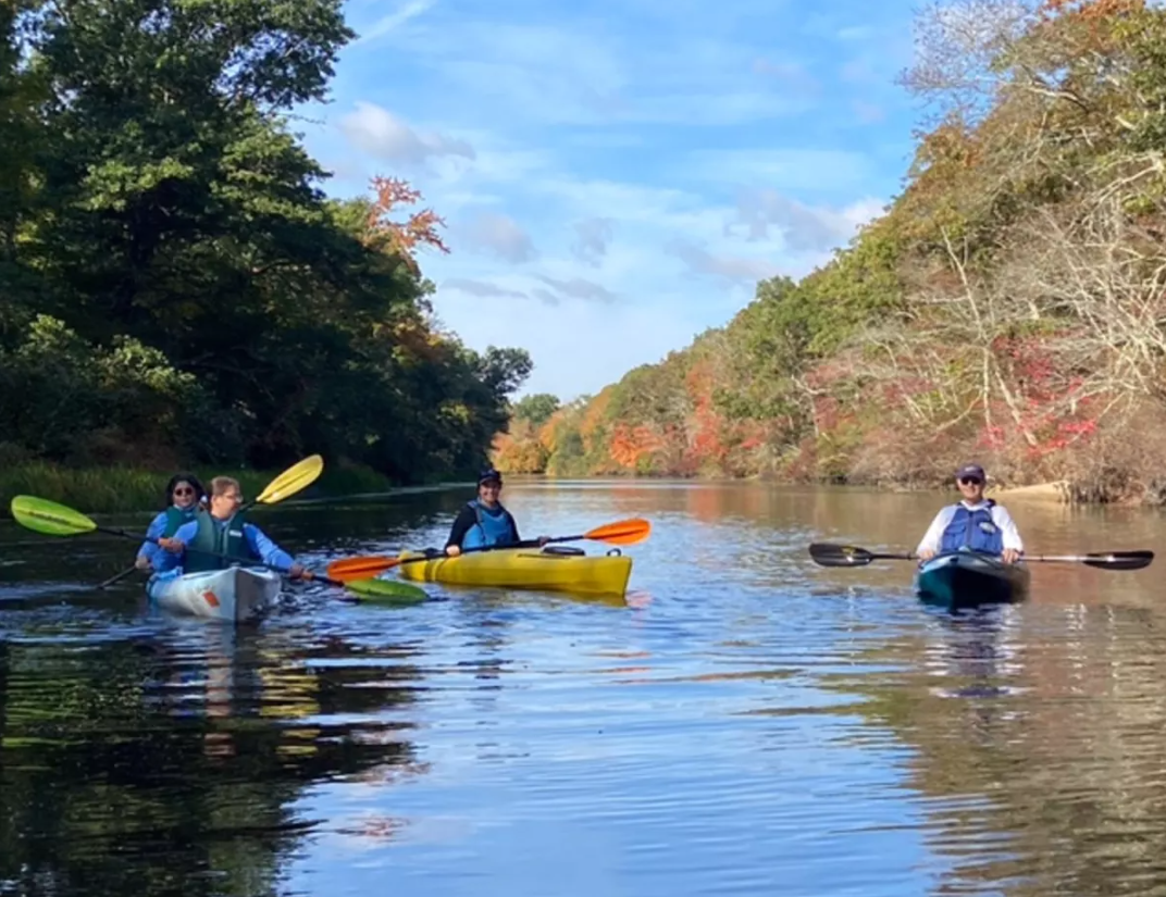
The Wood-Pawcatuck Watershed Association (WPWA) and WSR Stewardship Council make conscientious efforts to get residents out on the rivers. Getting folks out on the rivers is not only a great way to recreate, but also a way to educate a local community about how and why they should protect the waterway. The Wood-Pawcatuck Wild and Scenic Rivers Stewardship Council (Stewardship Council) is collaborating with the RI Department of Environmental Management (DEM) and the Connecticut Department of Energy and Environmental Protection (DEEP) to increase public awareness about access points to the newly designated watershed. Learn more about how paddling helps protect the rivers.
Photo: Jon Ericson, Stewardship Council Chair and Westerly Representative, and Lauren Barber, Westerly Representative, host a paddle for Town Planner Nancy Letendre and her daughter. Photo by Bill McCusker.
|
 |
Recreation - How a railroad helped protect a river (Westfield, MA)
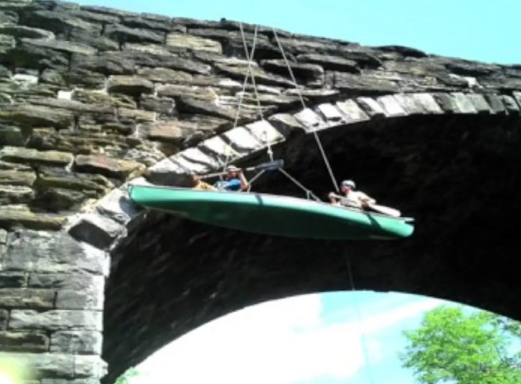
"That section is the longest stretch of free-flowing river in the state of Massachusetts,” explained David Pierce, President of the Friends of the Keystone Arches. "The Westfield River has three branches, and two have massive flood control projects (Knightville, Littleville). The West branch never got that treatment, even though up through the 1970's, eleven different flood control projects were put forward for the West Branch. None went forward, because the Legislature couldn't flood the railroad. So this historic railroad saved the natural state of the West Branch by its existence." Read more about how the railroad helped protect the river.
Photo: Volunteers used canoes to work on maintenance and repair the Keystone Arches. Photo credit: Keystone Arches website.
|
Topics in the Designate Section
|