- Home
- About
- Training & Events
- Resources
- For Members
|
Paddlers now able to explore recently designated Wild and Scenic Rivers with new content added to the National Rivers Project database and interactive map
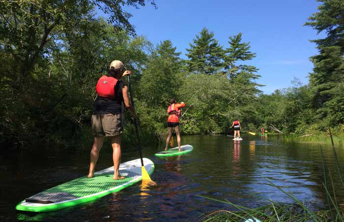
The National Rivers Project (NRP) has made it easier than ever for outdoors and paddlesports enthusiasts to explore new sections of America’s Wild and Scenic Rivers with the recent addition of 21 river segments and 46 access points. The NRP is the United States' ever-growing comprehensive, authoritative database and interactive map that records and shares paddling information for Wild & Scenic Rivers, water trails and select whitewater rivers. This information is sourced and vetted by local managers and is available to the public online at www.nationalriversproject.com. These recent additions are sections of 16 rivers in Massachusetts, Connecticut and Rhode Island that were designated Partnership Wild and Scenic Rivers (PWSR) as part of the John D. Dingell, Jr. Conservation, Management, and Recreation Act of 2019. “The National River Project enables local and out-of-town paddlers to plan an outing to experience the recreational, ecological, scenic, historic and cultural values that made these rivers worthy of Wild and Scenic designation,” said Jack Henderson, NRP Project Coordinator. “We really appreciate our partnership with the National Park Service, whose program support increased access and appreciation for all of our nation’s rivers.” PWSR designation differs from the more common Wild and Scenic River designation because the rivers are managed by the community through partnerships and agreements with the National Park Service (NPS), versus being managed solely by a state or federal agency. “Local watershed groups and other partners advocated for the protection and designation of these special rivers, and their hard work paid off with the Dingell Act designating these rivers as Wild and Scenic,” said Emma Lord, Natural Resource Specialist with the NPS Partnership Wild and Scenic Rivers Program. “Working with our local partners, we were able to provide river descriptions and access information to make identifying and planning a trip on these rivers easy using the National Rivers Project tools.” This landmark legislation protected more than 600 river miles on the Farmington River, Salmon Brook, West Branch Salmon Brook, East Branch Salmon Brook, Nashua River, Squannacook River, Nissitissit River, Pawcatuck River, Shunock River, Beaver River, Green Fall River, Ashaway River, Queen River, Usquepaug River, Wood River and Chipuxet River, as well as several rivers in Oregon, Utah and California. This brings the total number of Wild and Scenic River segments on the NRP website to 354. NRP is a growing national rivers geospatial map and database chronicling more than 1900 segments of North American rivers with helpful information like access points, fishing information and campsite locations. The website is clean and easy to navigate with high-quality mapping data and consistent attributes across each data entry. The project is managed by the River Management Society (RMS) in partnership with the National Park Service and a dedicated team of more than 50 federal, state and local partners. NRP’s full-scale interactive map is useful for both beginners and professionals. Novice paddlers will find easily-searchable information on hundreds of beginner-friendly river trips around the country (in most states) along with details to help their search and links to local managers who can provide the details necessary to plan the paddling trip. RMS and NRP are grateful for all partners involved, especially the National Park Service’s Rivers Trails & Conservation Assistance Program, the U.S. Forest Service, Bureau of Land Management and U.S. Fish & Wildlife Service. Additions and revisions to existing data are always welcome by visiting www.nationalriversproject.com. |

